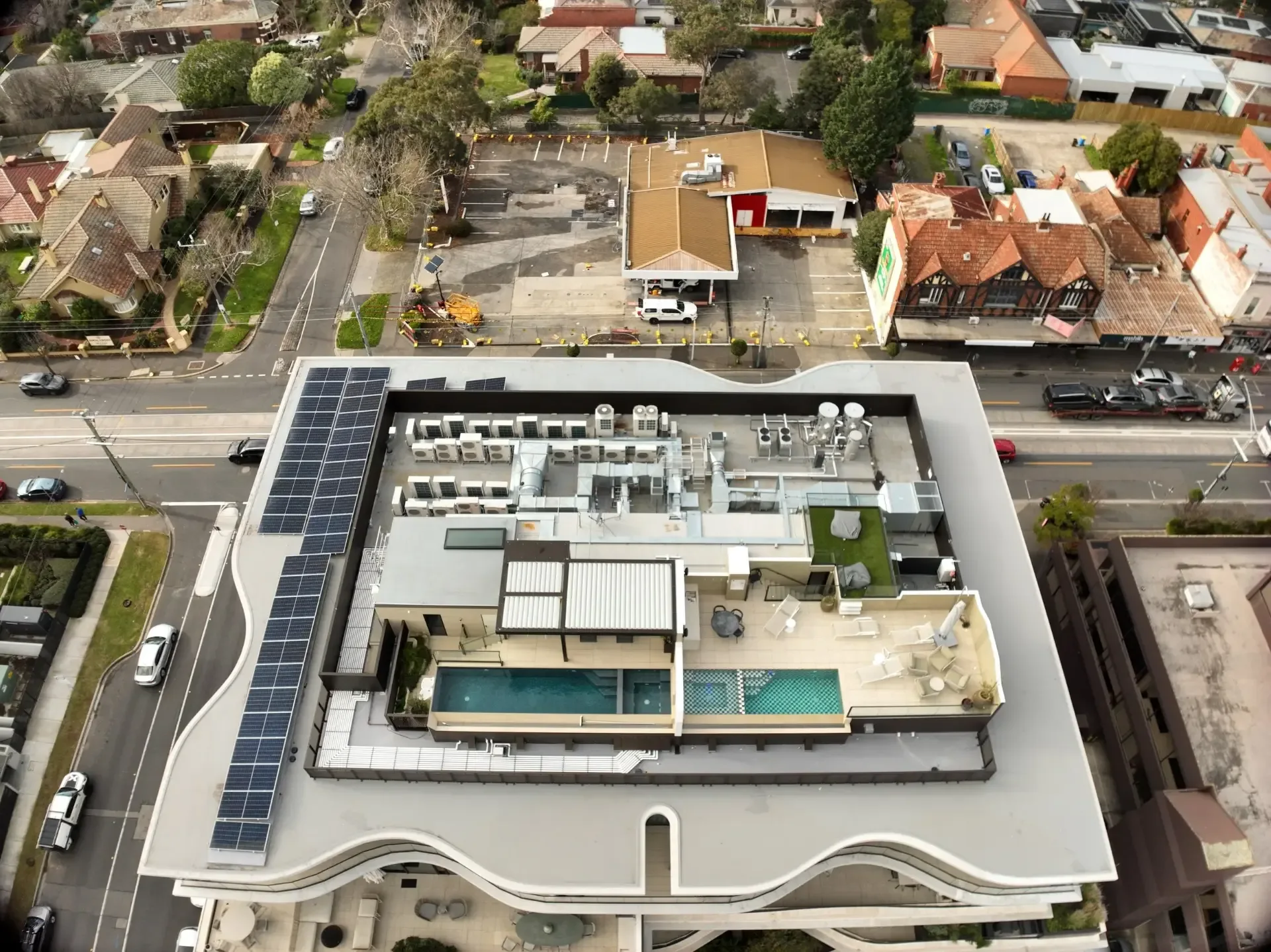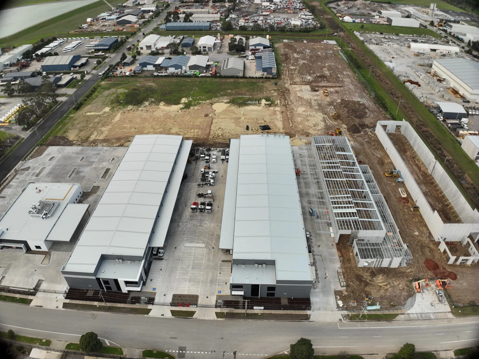
Construction progress monitoring
Four scheduled flights with aerial photos, video, comparison videos and a fresh orthomosaic map each visit — all on your own private project webpage.
Prefer to talk?
1300 49 42 99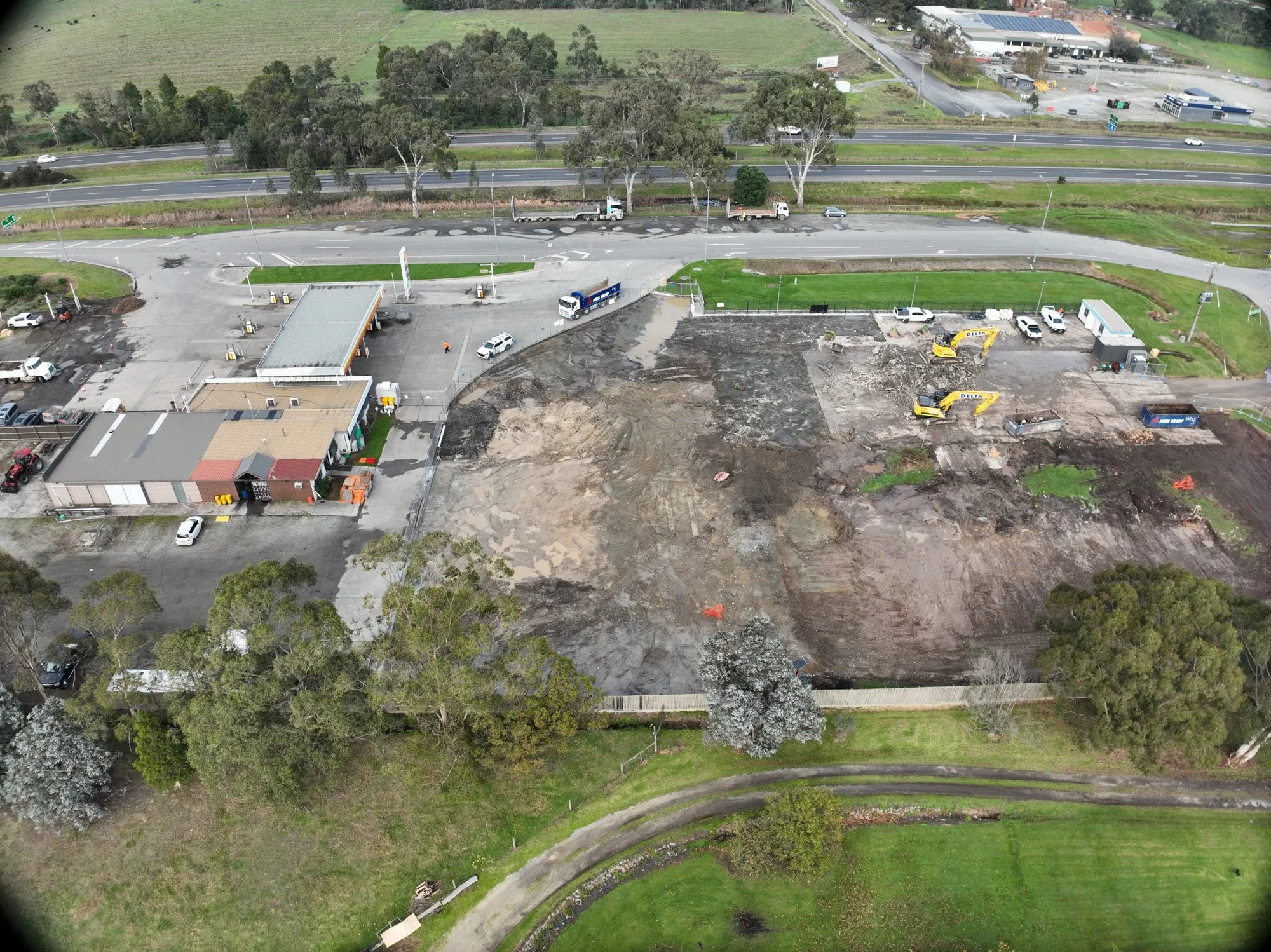
Builders · Developers · Victoria
CASA-approved · ReOC 97145.0 on Google
Progress photos, video and site maps from a pilot with 30 years on building sites. CASA-approved and $20M insured.
"Our goal is simple: provide reliable aerial data that improves visibility, supports safer operations, and helps projects stay on track."
Most drone operators come from photography. Brett came from construction — 30+ years on building sites and 3,500+ hours as a licensed pilot. Every flight follows CASA's CASR Part 101 rules.
You get photos, video, orthomosaic maps and RTK elevation data by secure link — plus a private project page your client, lender or investor can check anytime.
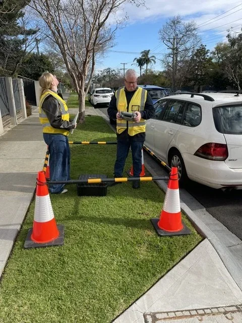
Our portfolio
Services
Four scheduled flights with aerial photos, video, comparison videos and a fresh orthomosaic map each visit — all on your own private project webpage.
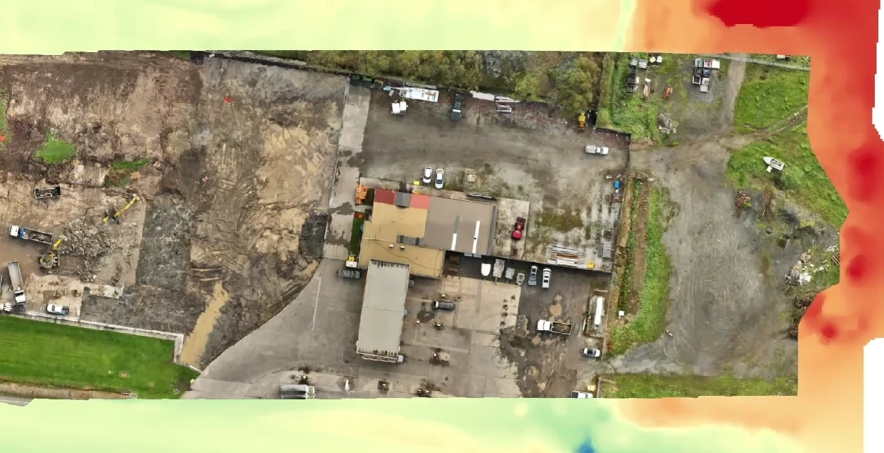
A scaled, top-down map of your whole site stitched from hundreds of aerial images. Ideal for tenders, planning, pre-start records and as-builts.
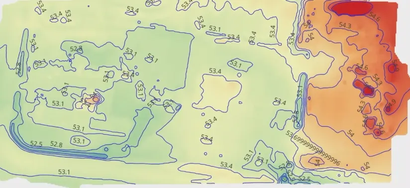
Current, high-resolution elevation data from an RTK drone and DJI D-RTK 3 base station. We work alongside your licensed surveyor.
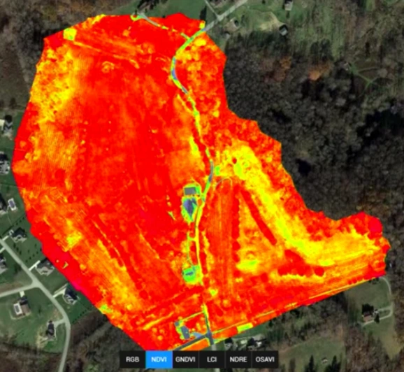
Spot crop and pasture stress before it shows from the ground. Pairs well with topographic mapping for drainage and dam planning.
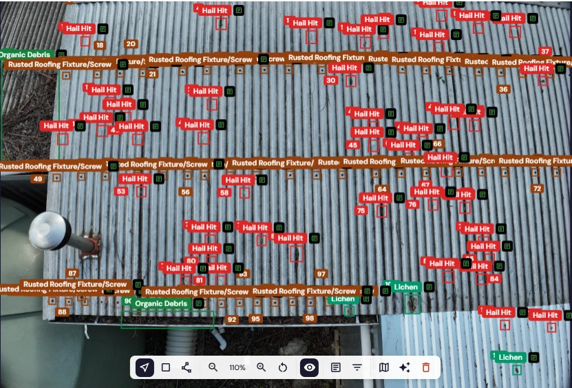
An independent drone-captured, AI-analysed report on roofing, gutters, solar and more. We don't sell repairs. View a sample report.
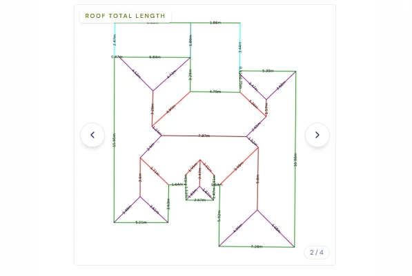
Roof measurements and material quantities from aerial data, so you can quote accurately without climbing up first.
Why builders call Brett
White Card held, PPE ready, inductions completed before the drone leaves the case. You notify your crew; we handle the flight safety.
Repeatable flight plans so progress comparison videos and before-and-after images line up visit to visit.
Sites near Melbourne Airport, Essendon or Moorabbin need CASA approvals. We organise them (additional fees may apply) and tell you the lead time upfront.
Imagery, maps and progress videos delivered by secure cloud link, plus a private project webpage for monitoring clients.
What you can check before you book
ReOC 9714 — check the CASA register.
Certificate of currency on request.
View an AI roof report before you book.
Unsafe to fly? We rebook at no cost.
White Card held. Your induction and PPE rules followed.
Opt out of marketing use, in writing, any time.
Based in Melbourne and flying across the state — metro building sites, regional developments and farms alike. Victoria is our patch, and we know its airspace, its councils and its weather.
FAQ
Yes. Precision Drone Services holds a CASA Remotely Piloted Aircraft Operator's Certificate (ReOC No. 9714), which is required to run a commercial drone business in Australia, and every flight is carried out under CASA's CASR Part 101 rules. We carry $20 million public liability insurance written for commercial drone work on construction sites and asset inspections, and can send you a certificate of currency before we fly. Brett also holds a current Construction Induction (White) Card.
Depending on the service: high-resolution aerial photos and video, 2D orthomosaic maps, elevation data, progress comparison videos or an AI roof condition report. Everything is delivered through a secure Google Drive link you can share with your team. Monitoring clients also get a private project webpage with before-and-after comparisons and the full image history. Final deliverables are released once the invoice is paid.
If rain, winds above 35 km/h, poor visibility or extreme heat make a flight unsafe, we postpone and rebook with you at no extra charge. Melbourne weather being what it is, we'd rather reschedule than give you data you can't use. If a flight can't go ahead because of something on site we weren't told about, like blocked access or an unnotified obstruction, a standby fee applies.
No — and it's worth being clear about this. We're a drone data capture specialist, not a registered building inspector, structural engineer or licensed surveyor, and the report isn't a legal document or compliance certificate. It's a detailed visual condition assessment of what's visible from the air, analysed by AI software. If you're buying a property, it's a useful extra, but you should still get a pre-purchase inspection from a registered building inspector, and have a qualified roofer or engineer review the findings before repairs or financial decisions.
Our topographic mapping uses an RTK drone, a DJI D-RTK 3 local base station and network RTK correction, which gives far more accurate positioning than a standard drone and far more current detail than public elevation data. Exact accuracy depends on the site, ground cover and conditions, so we'll talk through what you need before we fly. For title boundaries, legal set-out or certified surveys you'll need a licensed surveyor, and we're happy to supply data to yours.
Often, yes, but sites in or near controlled airspace need specific CASA approvals before we can fly. We'll check your site address as soon as you enquire, tell you what's needed and how long approval is likely to take, and quote any additional fees upfront so there are no surprises.
Yes — we service all of Victoria, from Geelong, Ballarat and Bendigo to Gippsland, the Goulburn Valley and the Western District. Put your suburb or town in the form, and any travel cost will be included in your quote before you book.
Construction progress monitoring, orthomosaic site mapping, RTK topographic mapping, paddock health scans and AI roof reports across Melbourne and all of regional Victoria. CASA ReOC 9714. $20M public liability.